
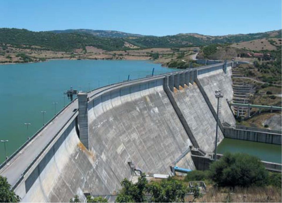
Water scarcity can develop even in regions that receive substantial annual precipitation. The problem often results from timing, location, infrastructure limitations, and water quality rather than a complete absence of water. Rainfall may arrive during a short period, snowpack may melt before summer demand peaks, and flood flows may pass through a watershed before utilities can capture them. Engineers use storage systems to retain water during periods of availability and make it accessible during dry seasons or prolonged drought.
Research published in Science Advances estimated that approximately four billion people experience severe water scarcity during at least one month each year. Monthly scarcity provides a more useful measure than annual precipitation totals in many settings, because annual figures can conceal seasonal shortages that leave municipal systems, farms, industries, and ecosystems all drawing on the same limited supply during the driest part of the year.
Bridget Scanlon, a senior research scientist at the University of Texas at Austin’s Bureau of Economic Geology, has studied groundwater depletion, recharge, drought, and the interaction between surface water and groundwater for several decades. Her research supports diversified water portfolios rather than dependence on a single reservoir, aquifer, or imported supply, an approach that combines several storage and supply options so that one part of the system can compensate when another becomes less reliable.
Effective water storage planning considers surface reservoirs, aquifers, managed recharge, recycled water, conservation, watershed conditions, and operating rules as parts of one system. Engineers evaluate how much water each component can store, how much operators can recover, what losses may occur, and how water quality may change during storage.
Seasonal and Multiyear Variability
Water systems must transfer supplies across both seasons and years. Snow may accumulate through winter and melt rapidly during spring, while agricultural and municipal demand often rises later, after streamflow has already declined, and a region may experience several wet years followed by a drought long enough to exhaust storage designed around shorter dry periods. Surface reservoirs address part of this mismatch by capturing water during higher flows and releasing it later for drinking water, irrigation, hydropower, flood control, and environmental purposes. Many communities depend on them precisely because natural river flow alone does not align with year-round demand, and without that stored buffer, supply and demand would rarely line up on their own.
But a reservoir’s original design capacity is not guaranteed to remain available throughout its operating life. Sediment gradually occupies storage space. Evaporation removes water from exposed surfaces. Drought reduces inflow, and operating requirements may limit how much water managers can retain. Downstream water rights, habitat needs, flood-control requirements, and water-quality concerns can all influence reservoir releases.
A global analysis published in Nature Communications examined reservoir storage between 1999 and 2018. Countries added substantial designed capacity through new construction, while the ratio of actual storage to designed capacity declined in many regions, indicating that added physical capacity does not always translate into a proportional increase in dependable supply.
Storage studies therefore need to distinguish between nominal capacity and usable yield. Nominal capacity describes the total volume a facility can hold under specified conditions. Usable yield describes the amount operators can reliably deliver after accounting for hydrologic variability, required releases, physical losses, and operational limits.
Sediment Management
Rivers carry soil, sand, gravel, and organic matter into reservoirs. Flow slows as it enters the impoundment, allowing much of that material to settle, and over time sediment deposits reduce storage capacity and may interfere with outlets, intakes, and other operating components.
A study published in Science estimated that existing reservoirs lose approximately 13.19 gigatons of storage each year. Sedimentation accounts for a substantial share of that decline, and the rate varies among watersheds according to geology, land use, slope, vegetation, wildfire history, and upstream development.
A severe wildfire can change sediment conditions quickly, since fire removes vegetation and alters soils, allowing storms to transport larger amounts of ash and eroded material into rivers. A reservoir that previously received moderate sediment loads may experience much higher deposition after a burned watershed encounters intense rainfall, and that shift can happen within a single storm season rather than building up gradually over years. Engineers can evaluate sediment before construction, during rehabilitation, and throughout reservoir operation using several complementary tools. Watershed models estimate erosion and transport, bathymetric surveys measure changes in reservoir geometry, and sediment cores and field sampling help characterize the material and identify possible contaminants before they become a larger operational problem.
Management options include dredging, sediment bypass, sluicing, outlet modification, and erosion control within the watershed. Each has limitations. Dredging can cost more than the value of the recovered capacity, especially when crews must manage contaminated material. Sluicing requires suitable outlet conditions and available flow. Watershed restoration may reduce future sediment without removing deposits that already occupy the reservoir.
Long-range supply estimates should account for expected capacity loss. A planning model that assumes constant reservoir volume may overstate the amount of water available during future droughts.
Coordinated Use of Surface Water and Groundwater
Scanlon’s work emphasizes conjunctive management, which coordinates surface water and groundwater rather than treating them as separate supplies. During wet periods, a utility or irrigation district can rely more heavily on rivers and reservoirs while reducing groundwater withdrawals, and during drought, groundwater can supplement reduced surface supplies instead. Surface reservoirs give operators direct access to stored water and allow them to control releases, though they also experience evaporation, sedimentation, and changing inflow that reduce their long-term reliability. Aquifers avoid most direct evaporation and can store large volumes over long periods, but excessive pumping can lower water tables, dry shallow wells, increase pumping costs, reduce streamflow, and cause land subsidence, so the tradeoffs between the two sources run in largely opposite directions.
Conjunctive management uses the strengths of both systems, and it requires reliable accounting. Engineers and water managers need to know how pumping affects connected streams, how quickly aquifers recover, and how much water remains available after losses.
Scanlon and her colleagues studied water management in California’s Central Valley and central Arizona. Historical pumping had created an estimated 44 cubic kilometers of available aquifer storage in the Central Valley and approximately 100 cubic kilometers in Arizona, volumes that indicate some depleted aquifers contain substantial physical space for recharge.
Groundwater depletion still creates serious damage, though. Land subsidence can permanently reduce aquifer storage by compressing sediment. Pumping can also reduce river flow and increase the risk that domestic or agricultural wells will fail. Engineers should treat available underground space as an opportunity for recovery, not as a justification for continued depletion.
Managed Aquifer Recharge
Managed aquifer recharge directs water into an aquifer through planned facilities or controlled use of natural channels. Engineers may use spreading basins, recharge ponds, dry wells, injection wells, or modified streambeds, drawing on sources that include stormwater, snowmelt, excess river flow, imported water, and highly treated recycled water.
Recharge projects can store water during wet periods and make it available during drought. They may also raise groundwater levels, reduce land subsidence, and support connected streams. Performance depends on local geology, water quality, recharge rate, and recovery conditions.
Aquifers do not function like empty tanks. Water moves through pores, fractures, and layers of rock and sediment, and permeability can vary substantially across short distances. One site may accept water quickly, while another may infiltrate too slowly to justify construction. Highly permeable material may improve recharge but allow stored water to migrate beyond the intended recovery area.
Engineers conduct hydrogeologic investigations to estimate infiltration, storage, and recoverability. They measure groundwater levels, hydraulic conductivity, aquifer thickness, and connections with rivers or neighboring aquifers, and they identify nearby wells, contamination sources, wetlands, buildings, and areas where a rising water table could create damage.
A U.S. Geological Survey study in Colorado’s Wet Mountain Valley evaluated aquifer storage and recovery through field measurements and groundwater modeling. Researchers collected groundwater-level data, streamflow measurements, aquifer-test results, and water-quality samples, and they found substantial variation in water-table depth and aquifer response across the valley, underscoring the importance of site-specific analysis.
Planners should select recharge methods only after they understand the receiving formation. Starting with a preferred technology and then trying to fit it to unsuitable geology can lead to low infiltration, poor recovery, or unintended groundwater movement.
Water Quality During Storage
Storage capacity has limited value when contamination makes the water unsuitable or substantially increases treatment costs. Engineers evaluate water quality before storage, during operation, and at recovery.
Surface reservoirs receive runoff from the entire upstream watershed. Agricultural drainage may carry nutrients and pesticides. Urban stormwater can carry petroleum compounds, metals, salts, and pathogens. Wildfire runoff can introduce ash, sediment, and organic matter that affect treatment and reservoir chemistry.
Reservoir stratification can also change water quality. Warm surface water may remain separated from colder deep water during parts of the year, and microbial activity consumes oxygen in the lower layer, creating conditions that can release manganese, iron, and nutrients from reservoir sediment.
A recent study of 357 large reservoirs found significant dissolved-oxygen declines in 74 percent of the systems analyzed between 1984 and 2023. Reduced oxygen can affect aquatic habitat and complicate drinking-water treatment, so utilities may need different intake depths, aeration systems, or treatment processes to manage these changes.
Aquifer recharge introduces different concerns. As water moves through soil and rock, chemical reactions can remove some pathogens and organic compounds, but the same reactions can mobilize naturally occurring arsenic, manganese, molybdenum, or other constituents. Changes in pH, salinity, oxygen, and dissolved organic carbon all influence these processes.
Engineers test source water, native groundwater, and aquifer minerals before selecting a recharge location. Monitoring wells allow operators to observe water movement and detect chemical changes, and projects may also require pretreatment to control pathogens, suspended solids, or compounds that could react within the aquifer. Recovery analysis should consider both quantity and quality, since a project may place a large volume underground but recover only a portion at a quality suitable for the intended use.
Integrated Hydrologic Modeling
Water agencies often manage reservoirs, groundwater, stormwater, and wastewater through separate departments. The hydrologic system connects them regardless.
Groundwater pumping can reduce streamflow. Lining an irrigation canal can reduce losses while also eliminating recharge that supported nearby wells. Stormwater capture can improve municipal supply but change downstream flow and sediment transport. Reservoir releases can meet current demand while reducing the amount available for a subsequent dry year.
Integrated models help engineers evaluate these interactions. The U.S. Geological Survey’s MODFLOW One-Water Hydrologic Flow Model can represent groundwater, rivers, reservoirs, precipitation, crop demand, and irrigation within one framework, letting planners test how pumping, recharge, land-use changes, and reservoir operations affect the full water budget.
Models support scenario analysis rather than prediction of one fixed future. Engineers may test normal conditions, short droughts, multiyear droughts, rapid population growth, wildfire, infrastructure failure, and reduced water quality, and they can combine these conditions to see how stresses compound. Low reservoir inflow may lead users to increase groundwater pumping. Increased pumping can lower water levels and raise energy costs. Deeper withdrawals may produce different water chemistry, and extreme heat can increase demand while wildfire affects the watershed at the same time.
Models depend on assumptions, calibration data, and available records. Engineers should document uncertainty and update the model as new monitoring information becomes available.
Operating Rules and Forecasting
Physical infrastructure determines how much water a system can hold. Operating rules determine how much of it remains available when it matters most.
Reservoir managers balance current releases against uncertain future conditions. Holding additional water can improve drought reliability but reduce available flood-control space. Releasing water before a forecasted storm creates capacity, although the system may lose valuable supply if the storm produces less inflow than expected.
Forecast-informed reservoir operations use weather forecasts, snowpack data, soil-moisture information, and hydrologic models to support release decisions. Operators evaluate several possible inflow scenarios rather than relying on one forecast, then compare the consequences of retaining or releasing water under each.
Managed aquifer recharge also requires operating rules. Water agencies need to define when water becomes available for recharge, who receives credit for stored water, and how much a user can later recover. Migration, evaporation before infiltration, water-quality changes, and other losses may reduce the recoverable amount.
Clear accounting prevents users from withdrawing more water than the system successfully stored, and it helps agencies coordinate storage among municipalities, irrigation districts, and other participants.
Demand Management
Conservation reduces the rate at which a region uses stored water. Leak detection, pressure management, efficient irrigation, industrial reuse, and landscape conversion can all extend reservoir and groundwater supplies.
Engineers can evaluate demand-management programs through the same reliability models used for storage infrastructure. A new reservoir may provide a specified drought yield. A combination of leak reduction, recycled water, and managed recharge may produce a similar improvement under some conditions.
The appropriate mix depends on the source of the shortage. A community with insufficient physical capacity may need additional storage. A system with substantial leakage may gain more reliability by repairing distribution infrastructure. A region with poor source-water quality may need treatment or watershed protection before it needs another storage facility.
Demand forecasts also require regular revision, since historical per-capita use may not represent future consumption after changes in plumbing standards, pricing, landscaping, or industry, and population growth and extreme heat may increase peak demand even when average use declines. Using several demand scenarios gives planners a more complete range of possible storage needs.
Environmental Water Requirements
Storage decisions affect rivers, wetlands, floodplains, and groundwater-dependent ecosystems, and engineers need to account for those effects when determining how much water a system can divert and store.
Seasonal high flows transport sediment, reshape channels, and connect rivers with floodplains, while lower flows support water quality and aquatic habitat during dry periods and groundwater discharge helps maintain streamflow after surface runoff declines. Capturing high flows can reduce these functions when storage operations remove too much water or alter the timing of releases, and groundwater pumping can reduce streamflow as well, even when wells sit at some distance from the channel. Environmental-flow studies identify the magnitude, timing, and duration of water needed to support river functions, and engineers can use those findings to establish diversion limits, minimum releases, and seasonal operating rules, while reservoir outlets may also let operators select release depths that provide more appropriate temperatures and dissolved-oxygen conditions downstream.
Managed recharge can sometimes support streams by returning groundwater gradually to the channel, though timing matters. Water that reaches the river after a critical ecological period may provide limited benefit.
Watershed protection can improve both environmental conditions and storage performance. Healthy soils, wetlands, and floodplains slow runoff and support infiltration. Forest management and erosion control reduce sediment entering reservoirs, and riparian vegetation can improve water quality before it reaches an intake.
Monitoring and Adaptive Management
Engineers need long-term data to determine whether a storage system performs as expected. Monitoring programs may include reservoir levels, groundwater elevations, pumping rates, water quality, sediment accumulation, evaporation, land movement, and streamflow.
Groundwater requires particular attention because declines remain less visible than falling reservoir levels. A global study published in Nature documented rapid groundwater declines in many aquifers, though the researchers also identified regions where water levels recovered after communities reduced pumping, increased recharge, or shifted to other sources. Recovery depends on local conditions and the timing of intervention. Land subsidence, saltwater intrusion, and contamination can create damage that recharge may not reverse, which is exactly why early monitoring gives agencies more management options.
Satellite systems can supplement field measurements. Researchers use satellite gravity data to estimate regional changes in total water storage. Satellite imagery and altimetry can track reservoir surface area and elevation, and radar measurements can identify land subsidence associated with groundwater withdrawal. These methods provide broad spatial coverage, while monitoring wells, stream gauges, samples, and inspections provide local detail, and engineers can combine both types of information to identify trends and investigate their causes.
Adaptive management uses monitoring results to revise operations. Agencies may reduce pumping, change recharge rates, modify reservoir releases, or expand treatment when data show that the system has moved outside expected conditions.
Reliability and Contingency Analysis
Average performance does not describe how a storage system will behave during every drought or emergency. Engineers also evaluate low-probability conditions and failures.
A drought may coincide with pump failure, wildfire contamination, or loss of an imported supply. A recharge project may accept water more slowly than expected. Recovery wells may produce lower yields or different water quality. Legal restrictions may prevent diversion during the period when recharge facilities have available capacity.
Contingency analysis identifies these vulnerabilities. Engineers compare backup sources, emergency interconnections, temporary treatment systems, and operating changes, and in some cases a second source can provide more reliability than additional capacity in the primary source.
The analysis should also address recovery time. A system may withstand one dry year but require several wet years to rebuild storage. A drought that ends meteorologically may continue hydrologically while reservoirs and aquifers remain below normal levels.
Storage Portfolios
A diversified storage portfolio can include surface reservoirs, groundwater, managed aquifer recharge, recycled water, conservation, and watershed-management measures, and each component addresses a different risk within the system. Reservoirs provide accessible short-term storage and operational control. Aquifers support longer-term storage with little direct evaporation. Recycled water can create a relatively consistent local supply. Conservation reduces demand on all stored sources, and watershed protection limits sediment and water-quality degradation before it ever reaches a reservoir or well. Engineers compare capital costs, operating expenses, energy use, water quality, environmental effects, legal availability, and recovery efficiency across these options, weighing how each one performs under drought, flood, and infrastructure failure before recommending a mix.
The total physical volume of a storage portfolio does not by itself determine reliability. Water must remain legally available, recoverable, and suitable for its intended use. A large recharge project may provide limited benefit when water becomes available only during rare floods or when recovery requires costly treatment. Long-term planning therefore focuses on dependable supply rather than total capacity.
Water Storage Planning and Water Protection
Water storage planning connects supply availability, infrastructure, water quality, operations, and environmental requirements. It allows engineers to compare several methods of retaining water and determine how they can work together. The process includes hydrologic analysis, demand forecasting, sediment assessment, hydrogeologic investigation, water-quality testing, environmental review, modeling, and long-term monitoring, and it also requires agencies to update assumptions as climate, population, land use, and infrastructure conditions change.
A storage system should provide enough flexibility to manage seasonal shortages, prolonged drought, and unexpected losses. Diversified systems generally offer more options than reliance on one reservoir or aquifer. Scanlon’s research supports coordinated management of surface water and groundwater as part of this broader approach. Wet periods can support aquifer recharge and reservoir recovery. Groundwater can supplement surface supplies during drought when earlier management has preserved sufficient reserves. Conservation and recycled water can reduce pressure on both.
The purpose of water storage planning is to improve the reliability and quality of future water supplies. Engineers accomplish that by evaluating how water enters storage, what happens while it remains there, and how operators can recover and distribute it under changing conditions.
